


Designing for places where there is no network, no base station, and no second attempt
An rtk gnss module for geological survey has to work in the places geological work actually happens: ridges, cuttings, river beds, and remote terrain where cellular coverage ends before the access road does. The design assumptions that hold for a surveying company working around a city — network corrections, a nearby permanent station, a vehicle to return to — do not hold in the field. The module and the workflow have to be built around that reality.
This guide covers what remote geological fieldwork demands from a GNSS module, when RTK is the right approach and when post-processed kinematics is more practical, how long baselines affect accuracy, and which logging, power, and environmental characteristics determine whether the equipment survives a multi-week campaign.
Field Conditions That Shape the Module Choice
Four conditions distinguish geological fieldwork from routine surveying.
- No correction infrastructure. Beyond the edge of a network, RTK depends on a locally established base. That changes the equipment list, the workflow, and the time budget for each session.
- Obstructed sky. A survey point is often at the base of a slope, in a gully, or under vegetation. Satellite visibility is partial for much of the day, and the module has to keep tracking through it.
- Power and weight limits. Equipment is carried on foot. Battery capacity is limited by what a person can reasonably carry, and every hour of field time depends on it.
- No second chance. Returning to a site may take a day. Data that is not logged correctly at the time may be unrecoverable, which makes logging reliability more important than any accuracy improvement.
RTK or PPK: Choosing the Right Method for the Field
Real-time kinematics requires a live correction link. Post-processed kinematics records raw observables and resolves the ambiguities later, using a base station file and precise ephemerides. In remote geological work, the second option is frequently the more practical one.
| Aspect | RTK in the field | PPK after the survey |
|---|---|---|
| Correction link | Required continuously | Not required during collection |
| Confidence in the field | Immediate, verifiable on site | Known only after processing |
| Equipment per crew | Rover plus base plus radio | Rover plus base logging |
| Recovery from error | Usually possible before leaving the point | Depends on logging quality |
Many geological teams use both: RTK where a base can be established within a few kilometres, and PPK for the days when the crew moves too far or the radio link will not hold. The module therefore has to support raw observable logging as well as real-time output, and the logging has to be reliable enough to trust when the crew has already left the site.
How Much Accuracy Geology Actually Needs
Not every geological application needs centimetre positioning, and treating them as if they do wastes equipment budget on tasks that do not benefit.
Mapping a lithological boundary, logging a structural measurement, or recording a sample location typically requires decimetre to sub-metre consistency, because the geological feature itself is wider than the positioning error. Establishing control points for a geophysical survey, monitoring a landslide, or referencing a drill hole requires centimetre-level accuracy, because the measurement is compared with other measurements over time.
The distinction matters because it determines whether the crew can work with a single rover in autonomous mode or needs a base and a fixed solution at every point. A team that specifies centimetre accuracy for boundary mapping will spend much of its field time waiting for a fix that the deliverable does not require.
Long Baselines and Base Station Practice
When the base station is several kilometres from the rover, the corrections become less representative of conditions at the rover. Ionospheric and tropospheric effects decorrelate with distance, and ambiguity resolution takes longer or fails. A single-frequency module struggles badly beyond a few kilometres; a multi-frequency module with good satellite geometry can maintain a solution much further out.
Field practice matters as much as hardware. The base has to sit on a stable point, ideally a known control station, with a clear sky view and no nearby reflector. A base set up beside a vehicle or under a cliff produces corrections that degrade the entire session's data, and the error is invisible until processing.
Where no control point exists, the base can be established in a static session and processed against a precise service later, which is the standard approach for surveys in areas without geodetic infrastructure. The module's ability to log high-rate raw data at the base is therefore as important as the rover's real-time performance.
Logging, Formats, and Data Integrity
A geological campaign produces data that will be processed weeks later, often by someone who was not in the field. Three design choices protect that data.
- Standard formats. RINEX and standard NMEA output make the data usable by any processing package. Proprietary formats that require a specific vendor tool create a dependency that outlives the equipment.
- Write integrity. Logging to removable media risks corruption if power is lost during a write. A module that flushes buffers correctly and can resume a file after an unexpected shutdown saves campaigns.
- Metadata. Point names, antenna heights, and observation durations should be recorded with the data, not in a notebook that gets separated from the files.
Power, Temperature, and Physical Survival
Field equipment spends a day in a pack and an evening on a charger. Two aspects deserve attention beyond the headline power figure. First, the current draw at the voltage the battery actually delivers, not at the nominal voltage, because a module that draws heavily near the end of the discharge curve will cut field time short. Second, the start-up current, which can be high enough to trip a small power bank.
Temperature range matters more than the datasheet minimum suggests. Equipment left in a vehicle overnight can reach well below freezing, and equipment in direct sun can exceed the ambient by a wide margin. A module rated across the full field range avoids the intermittent behaviour that appears only on the coldest morning of the campaign.
Yonghao Innovation Modules for Survey Work
Yonghao Innovation Tech is a national high-tech enterprise established in 2014, based in Shenzhen, Guangdong, China. We integrate research, manufacturing, and sales, and we supply GNSS satellite antennas, positioning terminals, data communication products, and customized high-precision BeiDou solutions for surveying and monitoring, aerospace, communication time service, autonomous driving, machine control, and intelligent transportation.
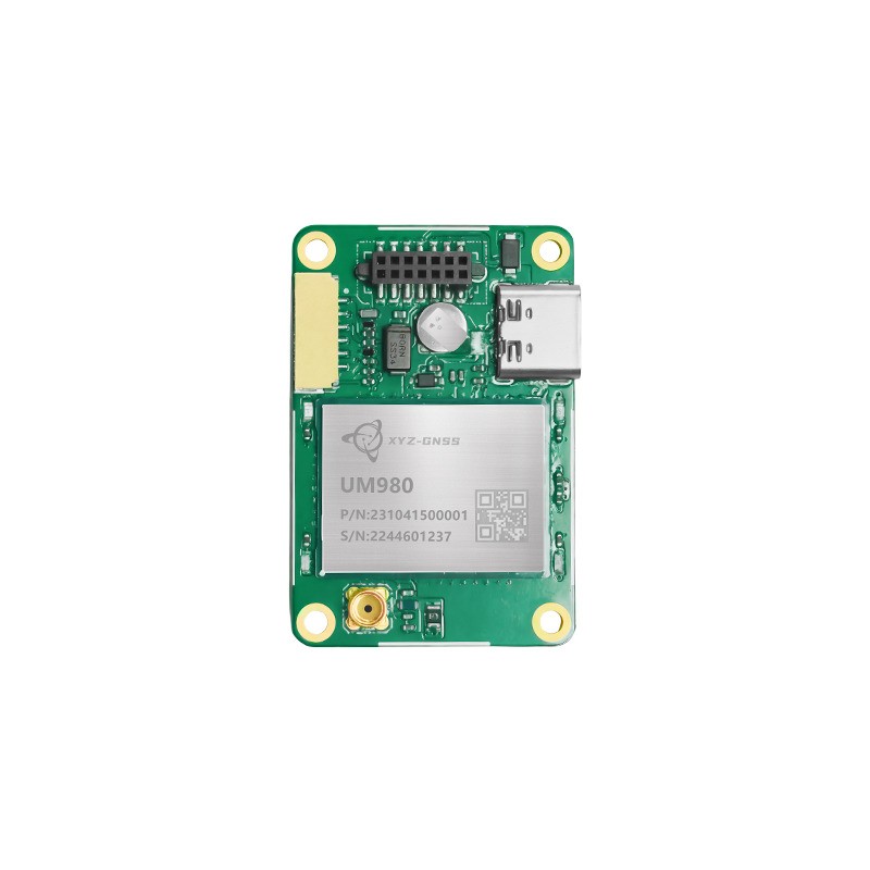
Our RTK GNSS module range includes engines suited to field instruments. The UM980 tracks BDS, GPS, GLONASS, Galileo, QZSS, NavIC, SBAS, and L-Band simultaneously, with built-in multi-frequency anti-interference technology that improves RTK performance under tree cover and in obstructed terrain. The K902 supports full-system, full-frequency reception with RTK, PPP, and SPP modes plus an integrated IMU, which suits handheld instruments that need a position while the pole is tilted.
Where a complete instrument is preferred over a board-level design, the RTK GNSS receiver range provides housed units built on the same engines. Typical survey configurations are shown on our survey project page, and our technical support team can advise on base station practice and logging configuration for remote campaigns.
Conclusion
Choosing an rtk gnss module for geological survey starts with the field conditions, not the accuracy figure. Remote terrain means no correction infrastructure, intermittent sky view, and limited power, which together favour modules that log raw data reliably, acquire quickly in obstructed conditions, and tolerate temperature extremes. Match the accuracy tier to the deliverable, plan for PPK where the radio link cannot reach, and treat data integrity as a specification rather than an afterthought.
Describe your survey area, typical baseline, and power source, and we will recommend a module and logging setup.
Discuss my field campaign See survey configurationsFrequently Asked Questions
Q1: Does an rtk gnss module for geological survey need network coverage?
Not if the workflow is based on a local base station and post-processing. Network corrections are convenient where coverage exists, but remote geological work usually relies on a base set up in the field and PPK processing afterwards.
Q2: How far can an rtk gnss module for geological survey work from its base?
Multi-frequency modules maintain a solution over considerably longer baselines than single-frequency ones, but accuracy degrades gradually with distance as atmospheric effects decorrelate. For work beyond a few kilometres, a closer base or a static control point is usually worth the extra setup.
Q3: What accuracy does an rtk gnss module for geological survey really require?
It depends on the deliverable. Boundary mapping and sample location typically need decimetre consistency, while control points, drill hole referencing, and deformation monitoring need centimetre level. Specifying beyond the requirement costs field time without improving the result.
Q4: Can an rtk gnss module for geological survey log raw data for PPK?
It should, and the logging capability belongs in the selection criteria alongside the real-time specification. Confirm the output format, the maximum logging rate, and how the module behaves if power is lost during a write.
Q5: How should an rtk gnss module for geological survey be powered in the field?
From a battery pack sized for the full day at the module's real current draw, with margin for cold conditions. Check the start-up current against the pack's protection limit, and carry a spare that can be swapped without losing logged data.